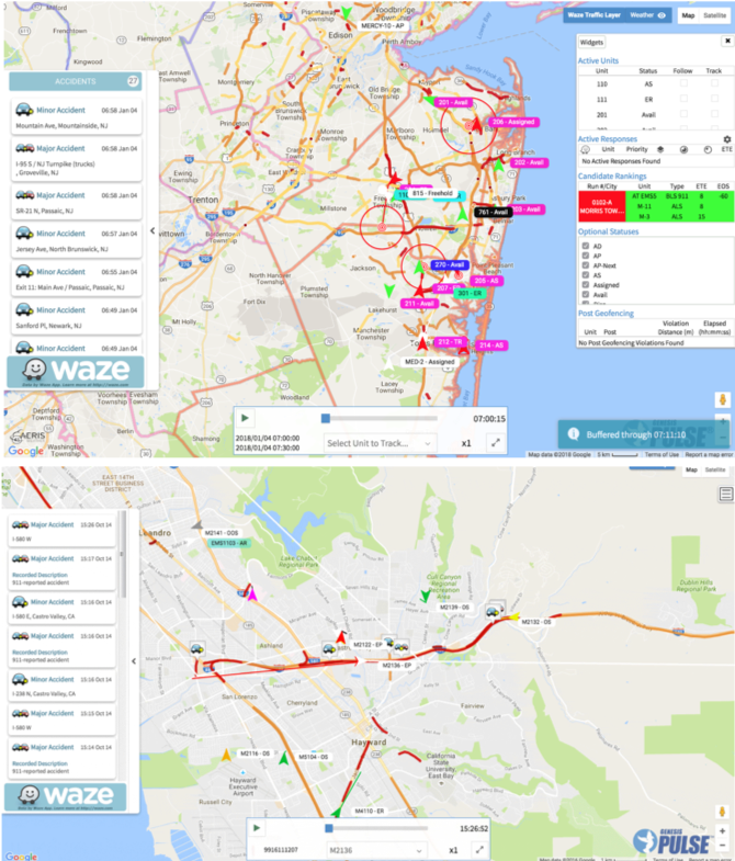
Real-Time Live Tracking
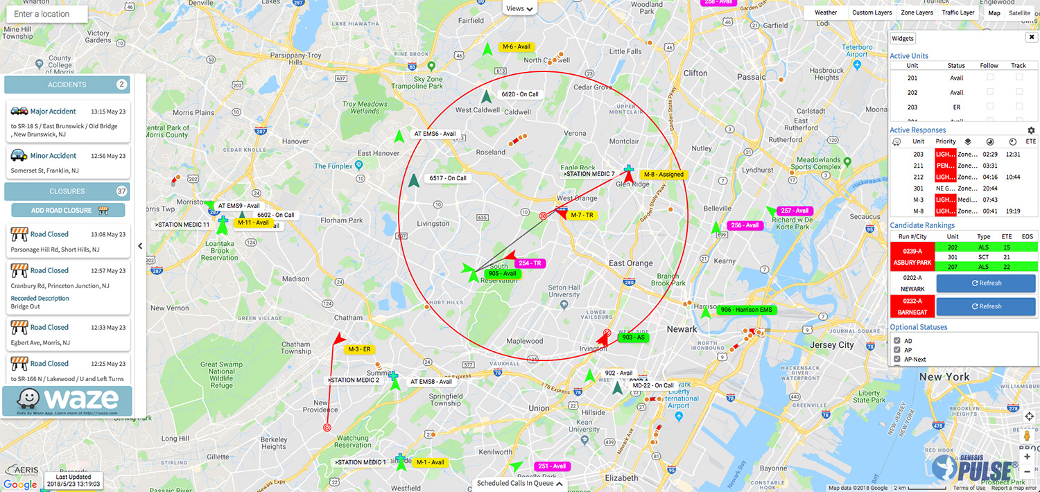 View all vehicles and personnel that need to be tracked in a single intuitive display for at-a-glance confirmation that operations are as expected. Displaying active units and responses with the PULSE visual response clock makes it simple to track performance on critical responses.
PULSE Live is browser-based for instant accessibility from anywhere. With a Google maps-base that includes the satellite and traffic layers and the integration of a live Waze feed that displays traffic crashes, road closures and weather alerts it’s simple to see the most important information in real-time. Schedule a webinar to learn about the practically limitless flexibility of PULSE.
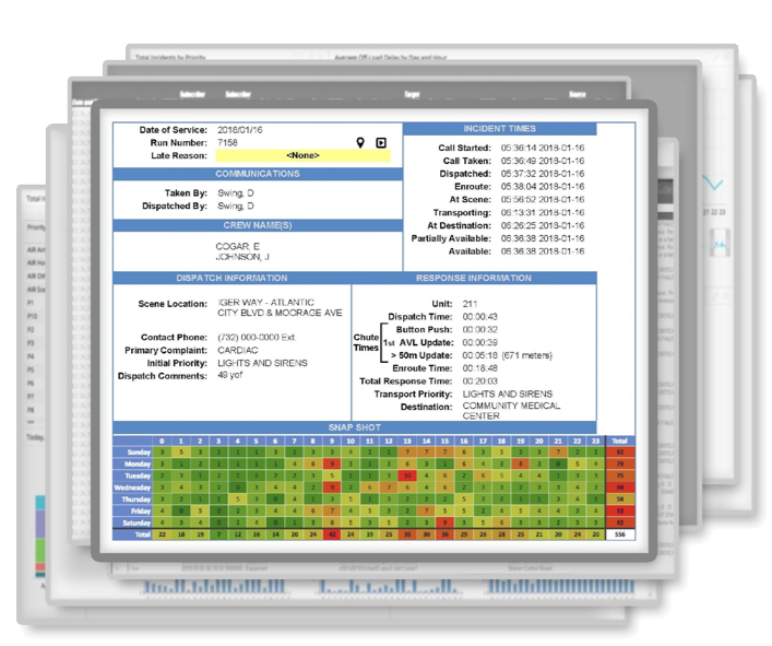
Real-Time Candidate Rankings
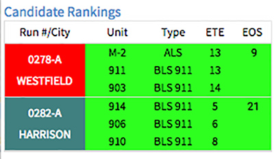 PULSE makes it simple to choose the fastest unit to respond to each incident because our Estimated Time Enroute (ETEs) calculations are the most accurate in any condition. For Candidate Rankings, PULSE live takes into account mode of travel (driving, biking, walking, etc.), road infrastructure, traffic, road closures, crashes, hazards, and weather when displaying a units ETE. This is significantly more accurate than as-the-crow flies and historical impedance data calculations. Our customers report that PULSE ETEs are on-point even in the most adverse weather and traffic conditions. Schedule a webinar to learn how PULSE candidate rankings are helping our customers to save time, money, property and lives.
Waze Road Closures
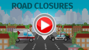 PULSE provides a simple interface to add road closures in your service area that are live in Waze within minutes! No map editing skills or switching to another application are required to help first responders avoid these costly obstacles. PULSE is the only application designed for emergency call centers that writes road closures directly into Waze. Schedule a webinar to learn about how to quickly add road closures to Waze via PULSE.